Historic Mason-Dixon map sells for $950,000
The 1768 survey drawing, which later defined the border between free and slave states, changed hands at a North Carolina auction.
By Ayanda Novak ·
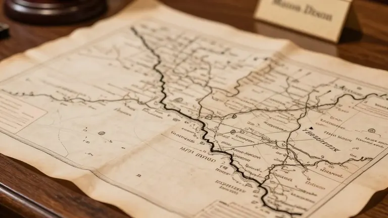
A hand-drawn survey map from 1768 that helped define the boundary between free and enslaved states in the United States sold for $950,000 on Thursday.
The auction took place in Asheville, North Carolina, hosted by Brunk Auctions. Forty-five bidders competed for less than three minutes to secure the document. Bidding began at $400,000 and ended below the auction house's high estimate of $1.2 million.
Lauren Brunk, vice president of the auction house, described the final price as very high for a map. The buyer requested anonymity for the time being. Brunk stated that the Library of Congress did not participate in the bidding, though the institution had previously attempted to acquire the map.
Charles Mason and Jeremiah Dixon completed the survey in 1768 to settle a border dispute between the colonies of Maryland and Pennsylvania. The line later served as a reference point in the 1820 Missouri Compromise, which limited the expansion of human bondage. The boundary became a symbolic divider in the years leading up to the American Civil War.
The map has a documented history of high-value transactions. Publisher Malcolm Forbes purchased the document in 1982 for $360,000, outbidding the Library of Congress. A subsequent sale in 2002 saw the price rise to $556,000. This latest sale marks a new record for the specific artifact.
A vertical section of the original survey, depicting the border between Delaware and Maryland, is currently housed at Princeton University. The main portion of the map, which sold this week, remains the most consequential cartographic record of the division that shaped early American politics.
Source: Daily Breeze